
I’ve had a few blog topics brewing in my head waiting for the right time to write, in some cases for a few years. I might be waiting to have the right photos to use, be in the right mood, or have a completed story.
This blog post is one example, and may have a more complete version later. When it’s ready. You got a glimpse in my Wigwam Hotel post earlier this week. I can only partially complete it now because I left a piece of the puzzle at home and need to scan some items to finish.
I’ve always enjoyed tracing old Route 66. Ever since one of my first cross-country drives (without a trailer) nearly 20 years ago. Driving on dirt roads crisscrossing under Interstate-40 via storm drains just big enough for a car. Dead ends.


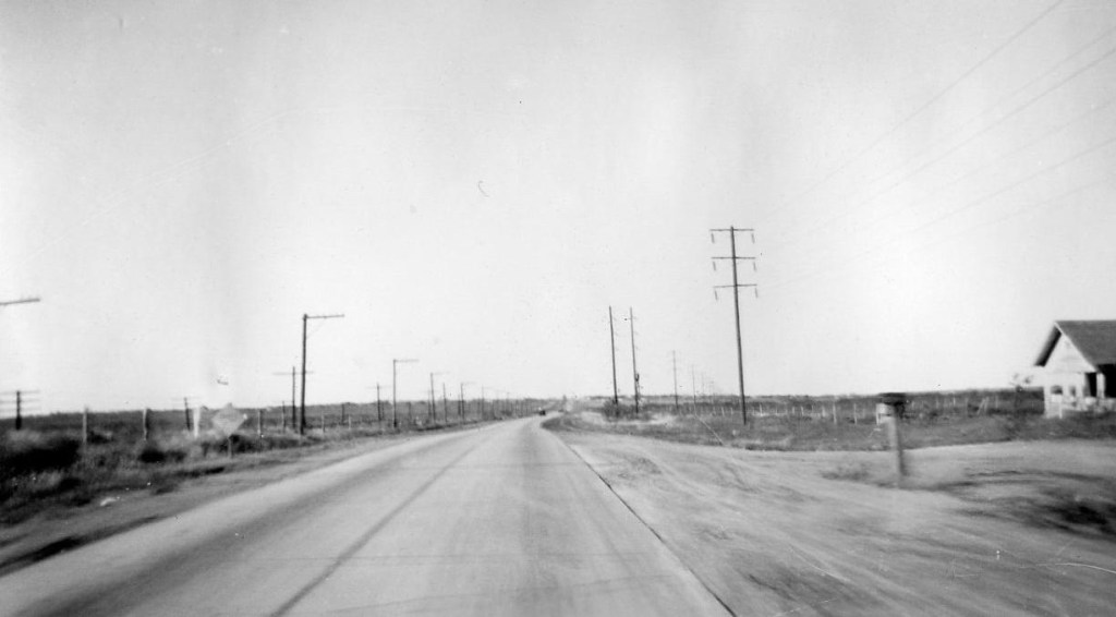
When I can’t find the telltale orange pavement, I make a travel game out of looking for long rows of old telephone poles next to railroad tracks – usually a good place to look. Oklahoma has some beautiful intact sections of that original pavement you can still drive on. Narrow, with a lip on the right edge of the lane. Large sections of concrete with seams every 30 feet. Grass growing in the gaps. In Texas you can see it dissolve in and out of frontage roads and overpasses built decades later.
The seeds of my appreciation for Route 66 may have been sown years ago.
Within days of being being married in November of 1935, my grandparents took a long honeymoon roadtrip to move from New Jersey to Berkeley, California.

They had a rakish new car (a wedding present). Route 66 was the southern route that would avoid the worst of the looming winter weather and one of the only coast-to-coast road that was mostly paved (The Lincoln Highway was completed earlier that year).
Why am I writing about this trip my grandparents took 87 years ago? How do I know their route? What they saw? Where they stayed?
Grandpa worked in a bank. Grandma had been a math and Latin major in college.
They documented everything.
Everything.
There’s a photo album with a detailed, dated index. (And thanks again, dad, for scanning all of these!)
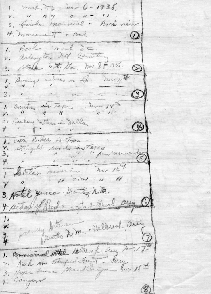
And… my grandfather saved virtually every receipt, map, national park brochure, matchbook… And put them all in a scrapbook.
For instance, they bought three Navajo rugs on that trip. Our extended family still has them – and the receipt.
I’m on the road with the Airstream, and that scrapbook is at home. Which is why I can’t do a full post on their trip.
But my one-opera summer in Santa Fe affords me close access to long stretches of their route along Route 66, and I have some time to trace it.


Like this place, for instance.

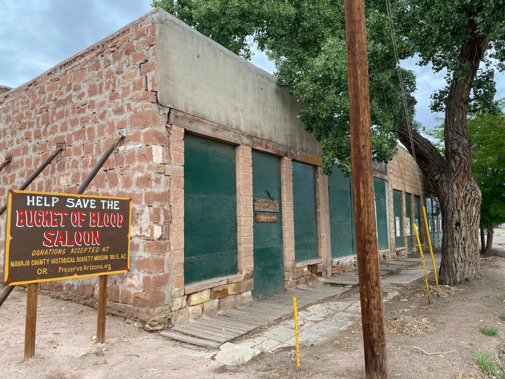
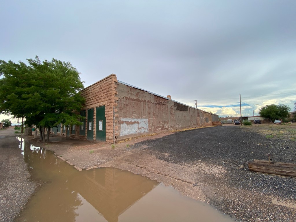
The “Commercial Hotel” in Holbrook, Arizona. They stayed here on November 17, 1935. My grandfather, and that new car (now coated in orange sludge from the road) are on the left.
At home, in that scrapbook, I’m sure there is a receipt from that stay. Maybe with an address. I don’t have that information. But while I’m camping here in Holbrook for a few days, I looked around for the hotel.
Given the bevy of semi-preserved buildings here, I was hopeful it might still be there in some other guise.
A gentleman in his 80s at the Wigwam Motel didn’t remember that hotel exactly, but drew me a map to where he thought it might be. Over the railroad tracks. Behind an old corner bar. Make a left at the waste transfer station and go down the dead-end street (thanks to a new overpass).


Close, but no cigar. But notice the long-brick construction under the 1950’s dive-bar facade that matches the style of the old photo. I’m getting warm.
Walking around the town that first morning at 6am, I also saw a row of buildings across from the old train station in “The Commercial District” that included the “Bucket of Blood Saloon” in a similar architectural style.

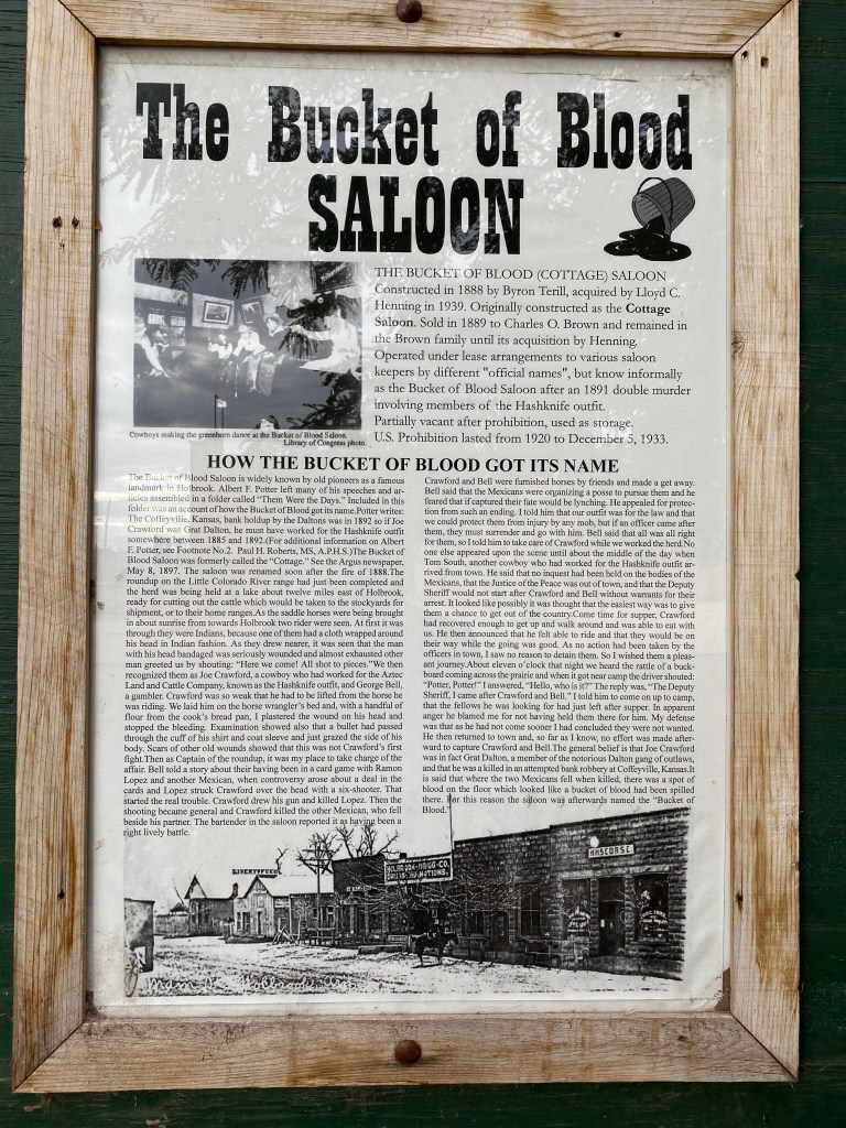
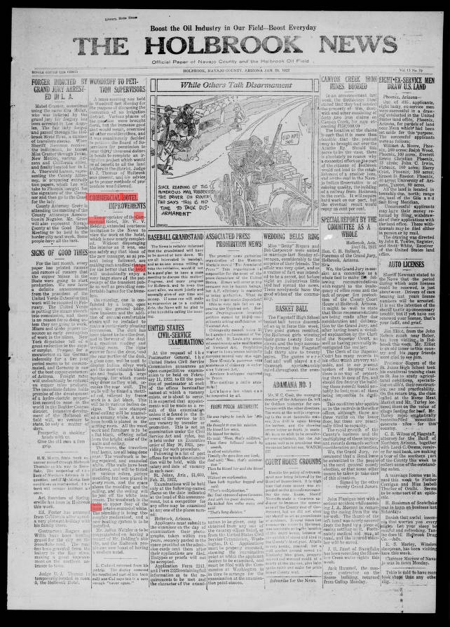
Internet searches weren’t very helpful, but scans of the “Holbrook News” told me:
– Electric street lights were installed at “Commercial Hotel Corner” in 1919.
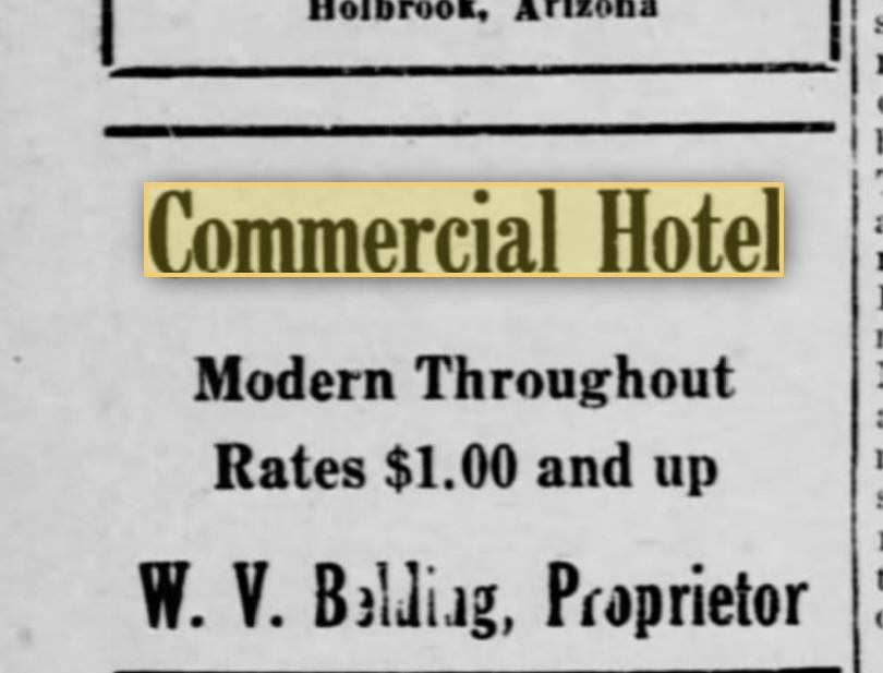
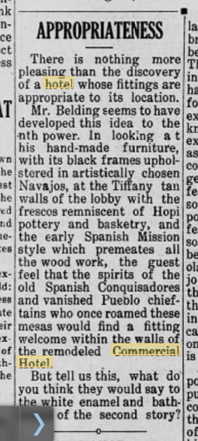
– The hotel had a standing daily ad on the back page in the early 1920s – without an address.
– Lots of people stayed there.
– They were “modern throughout” (in 1922) rooms could be had for $1.


I even tried the Navajo County Historical Society a few blocks away. I scanned every exhibit, diorama, and photo on the wall. Nothing.
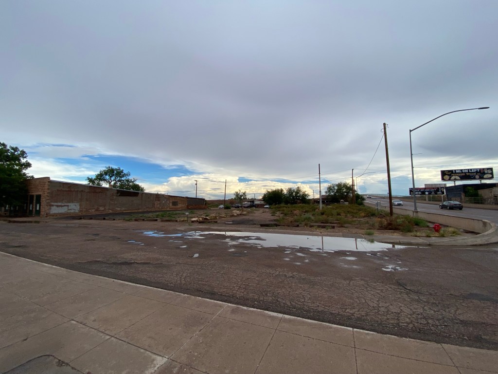
Except for one unlabeled photo in a large collage. A color rounded-corner photo, probably taken on an Instamatic camera in the 1970s or 1980s.

That’s the Commercial Hotel! Albeit soon after a fire… The little tree in the 1935 photo has grown considerably.
Now look at the bottom left of the photo. There’s a small alley between it and building to its left. That building has a white sign on the side. The only letters you can read are X and maybe E. It looks like a sign, anyway.
I walked back to the block with the B.O.B. Saloon and the “Commercial District” plaque. At the end of the row, next to a large empty lot, there’s the remnants of an old white sign on the side of the building.
To the right is a huge open lot across from the train station. About the width of the buildings in the 1935 photo. Next to the main road. On a wide street where cars could angle in, as in the old photo. On what was the main corner in town. A prime spot probably perhaps formerly known as “Commercial Hotel Corner”?
When I get home, will the hotel receipt in grandpa’s scrapbook have the address?
Maybe.
Either way, it was sure fun looking.
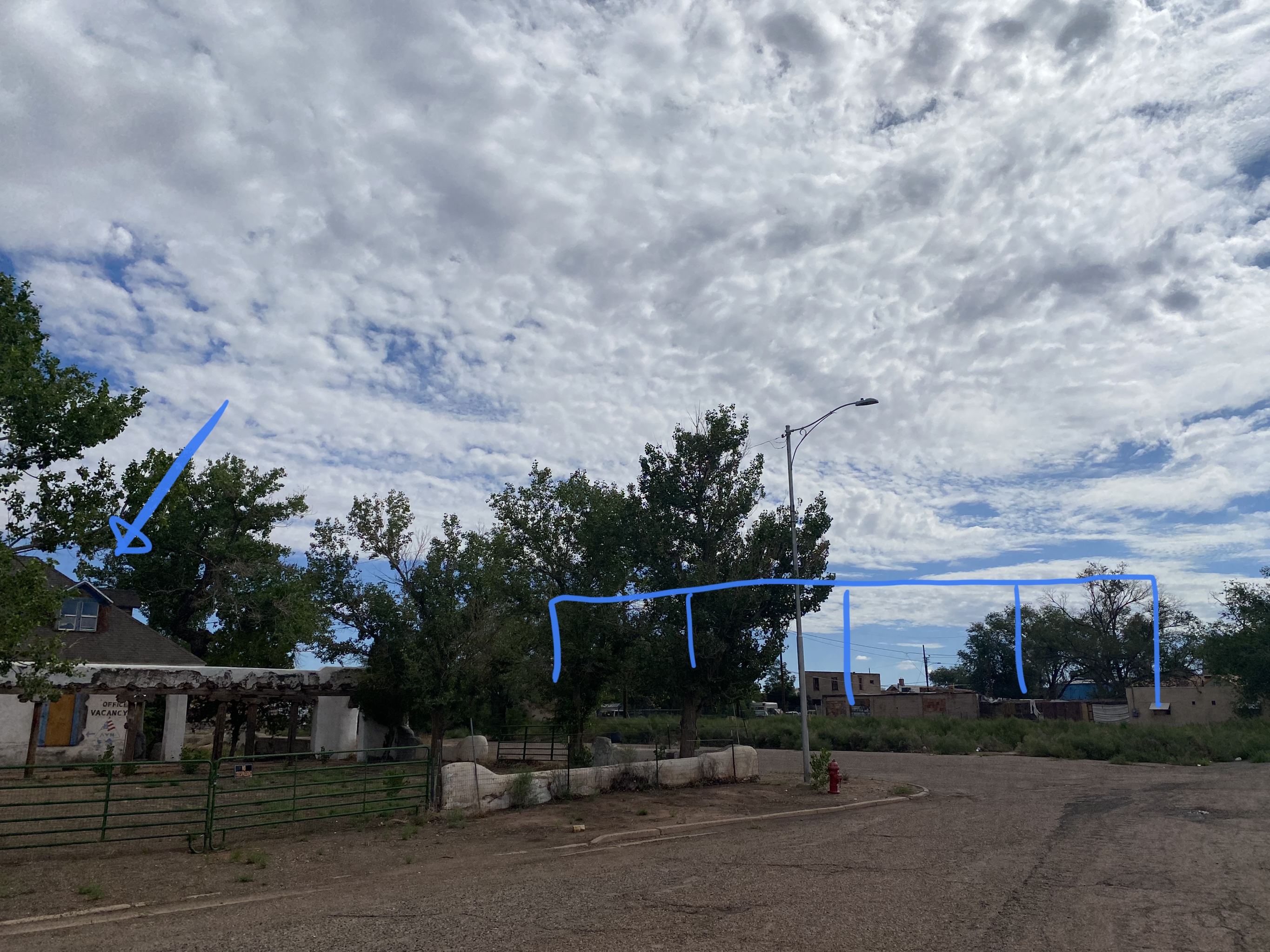
UPDATE: I was wrong. I revisited the Museum, and there were more photos upstairs. The hotel is around the corner in that dead-end neighborhood the older gentlemen at the Wigwam Motel told me about.
The Blue highlighted area is where I thought it was. The yellow is where it actually was. Across the street from the old Arizona Hotel )#70 on the map)
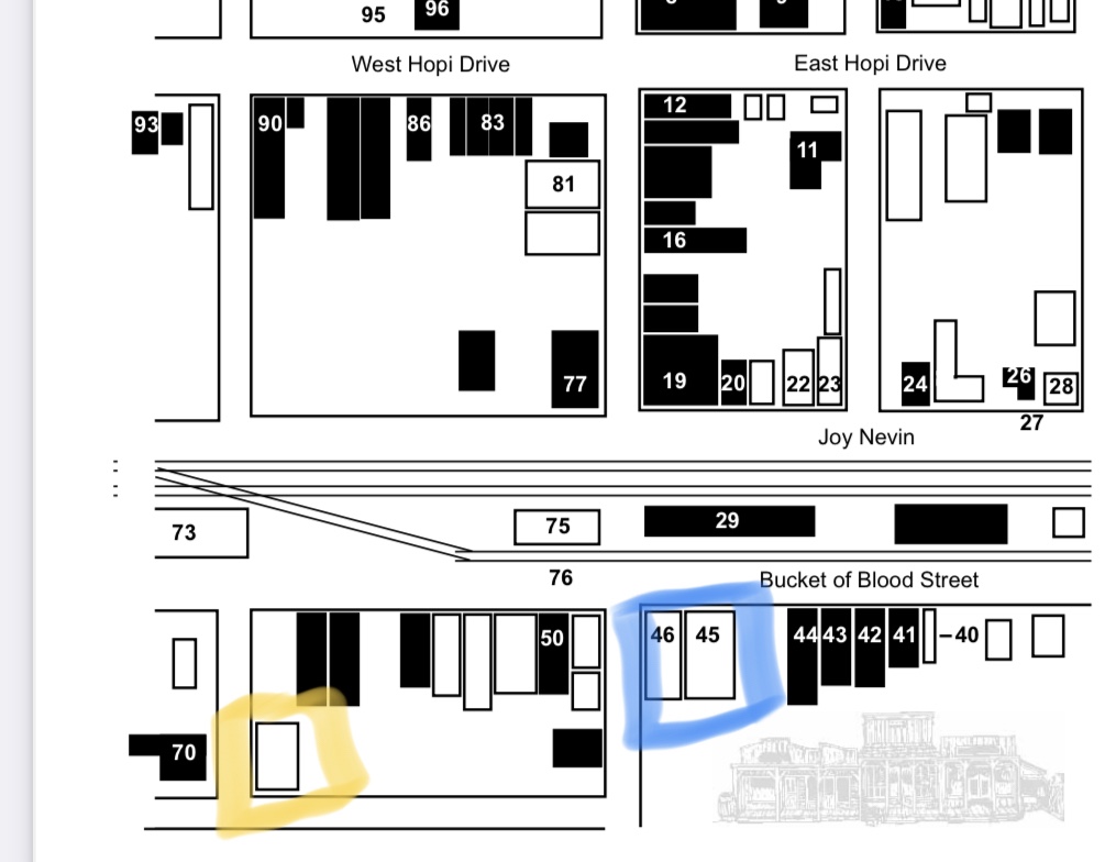
With a few more side-by-side photos I took this morning, here’s the proof.


7/30/2022 Saturday 10:15 p.m. PDT
Sent from Mailhttps://go.microsoft.com/fwlink/?LinkId=550986 for Windows
Fascinating! As in ‘Very’. Made more so by your inclusion of details and your writing style.
Hey! I’m loving these posts. What great sleuthing! Spent a lot of time in Holbrook, AZ, as we have family nearby and someone in my house likes to watch the millions of trains that roar through Holbrook (umm, not me)! As I write this, I am wearing a pair of moccasins I bought at “Geronimo’s” just off I-40 in Holbrook. Hilarious. Looking forward to more on your adventure (and your grandparents’)!
The Wigwam Motel is right next to the tracks. The teepees rumble as they go by. And as far as Geronimo goes, now I need to visit. Heading there now…. After some further research, I just updated the blog with an updated location for the Commercial Hotel – I was wrong!
Fascinating detective work, Dan. I must say that your grandmother looks extremely glamorous in her poses next to the car. Looking forward to more, including your excursion to Geronimo’s.